Land Levelling & Civil Earthworks
LevelGuide gives you complete control over how you move dirt, with accuracy and reliability.
Use simple plane control (to replace a laser plane), or full-3D design for a best finish with minimal dirt movement.
Single or dual-antenna for cross-levelling, or split the antennas between two implements, or between vehicle and implement for a cost-effective autosteer solution. Combine systems for autosteer plus multi-implement or cross-levelling.
Form contours, ditches, batters & dams, lay pipes, undertake surveys, and autosteer for lower fatigue.
Professional contractors use LevelGuide for thousands of hours per year, year after year.
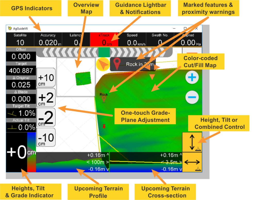
Intuitive User Interface
LevelGuide shows you your complete plan as well as cut/fill differences and optional cross-sectional profiles. Temporarily raise or lower the design to manage cut-depth on-the-go. Effortlessly switch between design features for on-the-go operation.
See guidance lines or install autosteer for optimized path following and reduced fatigue.

3D Design Options
LevelGuide provides survey capabilities, from which you can engage a professional 3D terrain designer or undertake a comprehensive 3D design yourself.
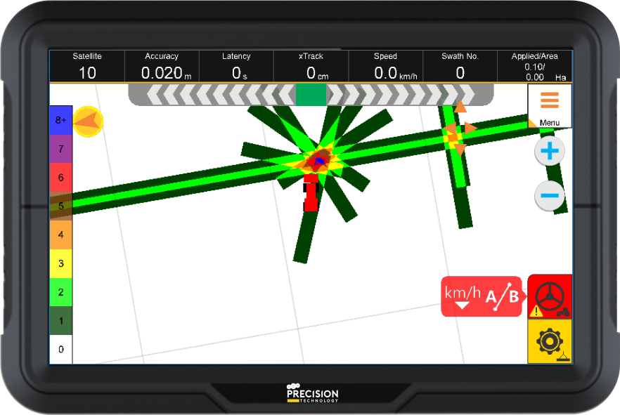
Compaction
LevelGuide can be used for pass-count for monitoring compaction for civil or agricultural purposes.
See a visual indication of where the vehicle/roller has been, and how many times that area has been covered.
Talk to us about your specific requirements.
LevelGuide delivering for Gore Earthmoving:
LevelGuide delivering for MR Earthmoving:

“I like to look at a completed job and see the water at the same level all the way around. Thanks to LevelGuide and the boys at Precision Technology, my life has been so much easier.”
Mick Rhode – MR Earthmoving

“To keep this grumpy old bugger happy, takes a fair bit!”
Ben Thomson – Stressless Harvesting

“They’ve improved our efficiency on farm, and they’ve also improved the accuracy for our fertilizer, and for our levelling.”
Kim Bremner – Farmer